Satellite based crop health monitoring
September 15, 2022, 11:19 pmIndia, the second-most populous nation in the world, guarantees the rest of the globe an army of skilled and devoted workers. Because of fragmentation brought on by population growth, the average amount of land that each new generation inherits shrinks, which is not something that agriculture players would be thrilled about.
Furthermore, an industry inextricably linked with the climate forces needs ground teams to be working in torrential rains and scorching heats to reach millions of farm holdings spread across the nation. Often it is easier said than done, the endless units of capital put into this mega task are a visible burden to any agribusiness operation in India.
Agriculture also demands innovations to address the constantly shifting need, powerful market forces, and lack of information about supply and demand. The lack of real-time farm statistics and data for corporations, as well as the gaps in knowledge about demand and supply, hinders their productivity and efficiency in planning sales, marketing, logistics, and other managerial operations, which lowers potential revenues.
Finding such information is not always simple. It frequently lacks or is outdated.
Agro holdings and investors cannot afford the luxury of picking a land site randomly in the modern world. Understanding how prospective the land is is very crucial because such investments carry considerable risks.
This is when satellite monitoring is used, offering a range of options for assessing the condition of agricultural fields.
Manual Field Assessment Takes Time, Money, And Effort and the usual ways are not always justified. As a result, auditing often takes a lot of time and resources, but still does not provide accurate data.
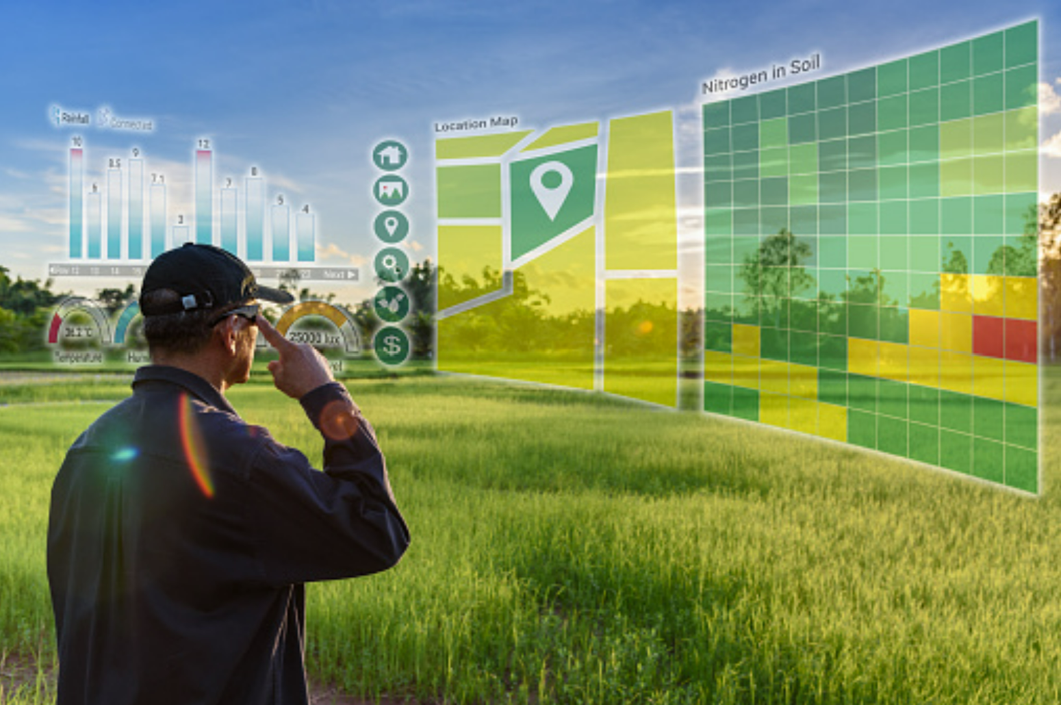
Satellite monitoring is the missing link in a successful implementation of sustainable practices backed by agronomical insights. The analysis of satellite images enables you to keep an even closer watch on your fields and catch problems you may not otherwise have seen. Satellite based crop monitoring helps you in monitoring large farms remotely. It alerts the farm managers in locating the problematic zones at the right time without making unnecessary field visits and thereby optimising costs.
Without an accurate method of monitoring outcomes, it is difficult to determine how well decisions are working.
- Contract Farming companies can use the crop monitoring platform to monitor agriculture fields for minimizing risks, prevent field losses, and powerful analytics for proper decision making with regards to crop development.
- Agro chemical and seed companies can use the crop monitoring platform for conducting field trials and locating the potential spots for generating demand for its products (potential business areas).
"Farm Layers" provides agribusinesses with vegetation maps. The indices currently available are: MSAVI, NDMI, NDVI, NDRE that helps in monitoring different stages of the crops in a growing season. It has covered information on all the field crops, with some horticulture crops like tomatoes, okra, brinjal, capsicum and much more.
There are upcoming features covering advanced analytics in subsequent releases which will help agribusinesses in mapping the entire crop journey from pre-sowing till the harvest.
- OPTIMIZE INPUTS APPLICATIONS WITH FARM LAYER
- OPTIMIZE R&D and OPERATIONAL COST WITH FARM LAYERS
- BOOST SUSTAINABLE PRACTICES WITH FARM LAYERS
.png)

.png)
Food Crisis: A threat to life
Posted March 3, 2023, 1:30 pm